See also The Pound. Not all links on this page have been uploaded to this public selection of my pages on the web. Please do ask for individual pages to be uploaded if they are of interest to you. Further information is available on a private page here.

Poundside Cottage from the road
Revision Note 13th December 2025: The new owner of this house kindly showed us round today, from which I now have a much clearer view of the history and will update this page shortly to reflect this new information. I'm most appreciative of the time taken to show us round - thank you. As far as dating is concerned, what we've seen confirms that the entire brick built part of the house is later than the 1924 map below, as already suspected. However, the weatherboarded timber single storey part of the house on the north side aligns with earlier maps and allows for a possibility that this might be rather older. The house was built in three distinct stages - I'll follow that up on later maps and with other sources.
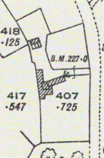
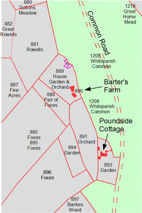
Poundside Cottage lies on the west side of Common Road to the south of the village and immediately south of Whiteparish Garage. In the 1842 Tithe Award there were two cottages here, each having a small garden, and various outbuildings. Two extra pieces of land nearby were also catalogued as garden, as well as an orchard. One of the larger garden areas immediately south of the cottages extended across the strip of The Common west of Common Road to the edge of the road, at that time the only property that had taken in land across this strip. Maps show regular alterations to the associated outbuildings through the years, but it is hard to be sure whether the house is still on the original 1842 alignment, or whether it has been rebuilt since in a slightly different position. As discussed below, my current view is that the house was probably rebuilt later than 1924, but this is by no means certain. The village pound stood just to the north within the area now occupied by Whiteparish Garage, which itself still has "The Pound" as its address.
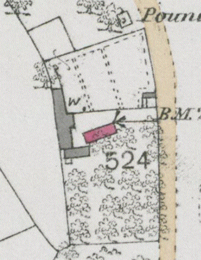
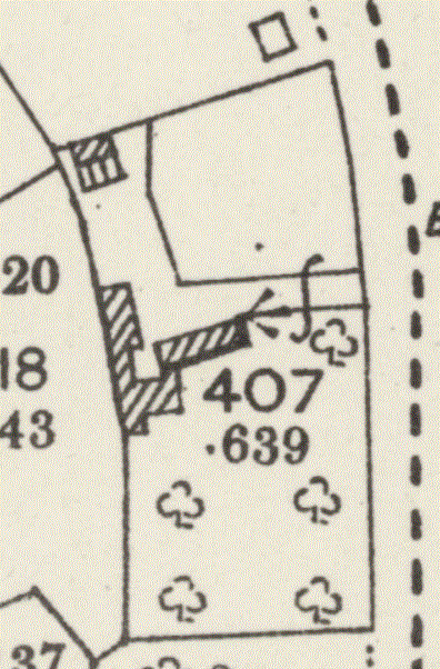
The Poundside Cottage buildings in 1842, (1842 annotated tracing) 1876, 1900, 1924, 2022, 2022
 .
.
1842 Tithe Map, with an annotated tracing on right [label the original and remove the tracing]
The house and outbuildings 889 remained as a reduced building (probably just the house) until about 1900, but there is no modern building on the site

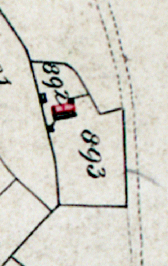
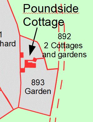
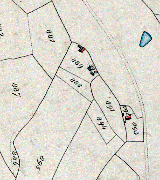
Detail of the buildings shown on the 1842Tithe Map
The two cottages 892 are shown on the map in red, with associated farm buildings in black
892 Two cottages and gardens
893 Garden
894 Garden (just the corner shown here, can be seen on the wider scale map above)
Analysis of the site
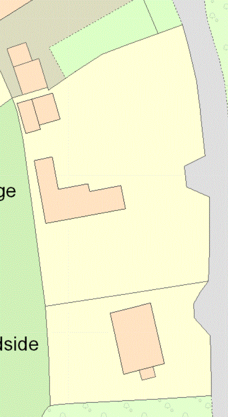
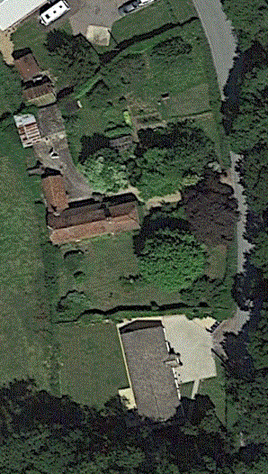
The map below is based on a modern map, with tracings of the 1876 and 1924 maps and 2022 aerial photography overlaid. The aerial photography tracing of the house matches the modern map well, but fails to align with the 1876, 1900 and 1924 maps. The 1900 and 1924 maps are the same here. Alignment of the various boundaries is imprecise, but falls within the width of the boundary features like hedges.
.gif)
Poundside tracings overlaid [plan to improve this Jan 2025]
Modern map has grey pixellated edges, aerial photography thin black line, 1876 magenta, 1924 blue, (red modern boundary of Whiteparish Garage)
[origin WPM/Whiteparish Garage and the Pound.odg]
The initial hypothesis suggested by this attempt at aligning features is that the two 1842 Poundside cottages were changed into a single house, which appears to have been demolished and rebuilt on a different alignment between 1924 and 2022. Most of the other buildings have undergone steady changes through these various map editions. The 1842 Tithe map aligns well generally, but the surveying there is not sufficiently accurate for this to help. For reference, the southern edge of The Pound can be seen at the top right corner of this tracing in magenta.
As far as the northern boundary alongside the Pound is concerned, I'm pretty convinced that the old and new boundaries all match along the section nearest the road, as shown above. This alignment places the Pound astride the present [2022] front fence of Whiteparish Garage, and a short distance from its southern boundary. Research into more detail is ongoing.
Further information on Poundside Cottage is available here.